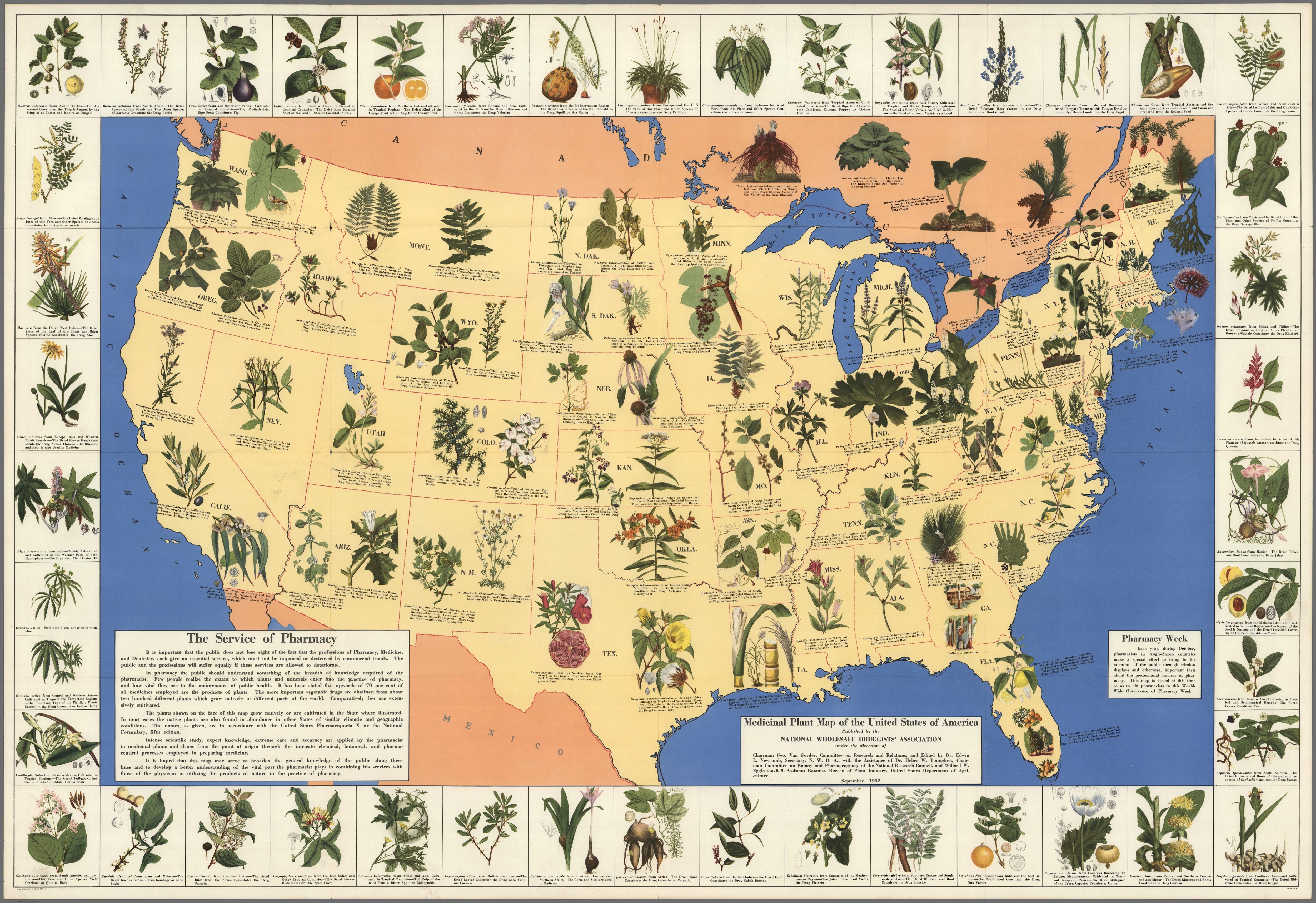
1930’s Pharmacist Map of Herbal Cures

1930’s Pharmacist Map of Herbal Cures
Click to enlarge

The map depicts different plant species that grew in each state of the United States in the 1930’s. It was printed by the National Wholesale Druggists’ Association, and serves as a fascinating reminder that, in our not-so-distant past, medicine was one hundred percent natural. Different herbs and plants were prescribed for different diseases, and people knew that healing takes time. When the 1938 Food, Drug & Cosmetic Act was passed, however, the landscape of medicine changed, and a federal regulation was put into place to govern the production of new medicines. The pharmaceutical industry completely took over, and our knowledge of herbal medicines was lost and shunned. As a result of these regulatory changes, medicine relying on synthetic chemistry took over, and pharmacists lost the ability to prepare medicine straight from the earth.
Source…


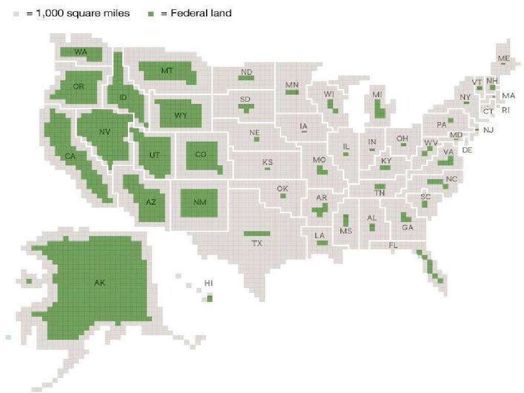
How Much Land The Government Owns In Every State

How Much Land the Government Owns In Every State
Click to enlarge

The Constitution allows the federal government to possess land in three forms: territories, enclaves and other property. Territories referred to land that was owned by the federal government but had not been formally made into states. Enclaves referred to land within a state that was owned by the federal government for essential purposes such as ‘Forts, Magazines, Arsenals, dock-Yards.’ Other property refers to land holdings for enumerated purposes, and gives the federal government limited discretion to possess land.

The rise of progressivism in America can be clearly seen by taking a look at what land the government owns.

The eastern two thirds of the country have little federally owned land. The dominant belief at the time these states were developed was that private property is a natural right of the individual.

The government needed land only to fulfill its basic duties. There were Federal buildings, post offices and post roads, public parks and libraries, but federally owned land was kept at a minimum. The government mostly stayed out of the way, leaving the majority of land to private ownership.

Western states are different. Land ownership is inverted, and the feds own an overwhelming majority of the land. The dominant belief had shifted by the time these states were developed. By then, the new and dominant theory of progressivism had emerged.

Read more…


via

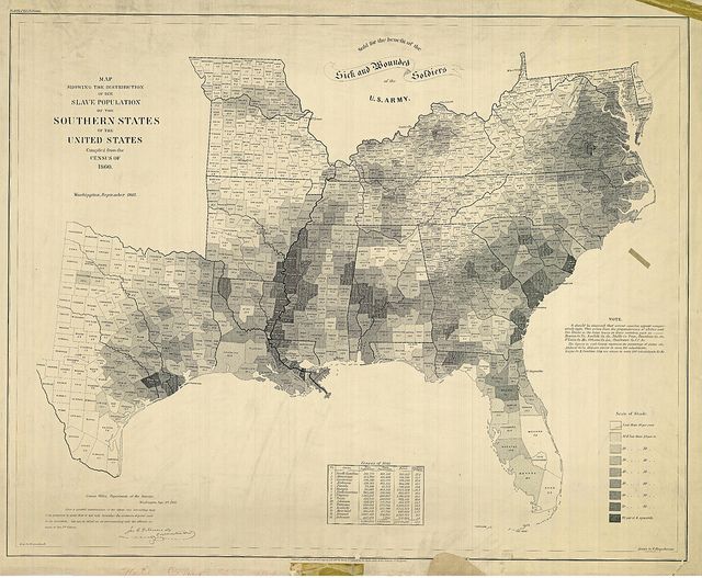
American History: A Map Of American Slavery

A Map of American Slavery

A Map of American Slavery

One of the most important maps of the Civil War was also one of the most visually striking: the United States Coast Survey’s map of the slaveholding states, which clearly illustrates the varying concentrations of slaves across the South. Abraham Lincoln loved the map and consulted it often; it even appears in a famous 1864 painting of the president and his cabinet.

Related Article in Disunion
PDF of the Map


Load More