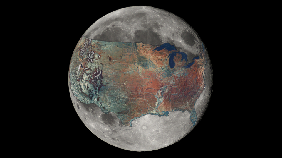
And now for a sense of scale: a map of the U.S. overlaid on the MoonThe greatest distance between two points within the contiguous U.S. is 2,892 miles, stretching from Point Arena, CA to West Quoddy Head, ME*. The circumference of the Moon is 6,784. To help put the scale of each into perspective, redditor boredboarder8 decided to overlay one on top of the other, giving rise to the approximation you see above. [Click here for hi-res] Writes boredboarder8:
We repeat: this is just a rough estimate, but it’s certainly good enough for government work when it comes to illustrating the Moon’s relative dinkiness. (Or America’s hulking hugeness, depending on how patriotic you’re feeling.) It’s strange — when we imagine objects in our solar system (even ones we know to be “small,” relative to other celestial bodies) I suspect that many of us regard them as just being unrelatably huge. They exist at scales so large, and at distances so vast, that numbers relating to mass, surface area and volume — descriptive though they may be — are rendered effectively meaningless. So it’s always nice when images like this come along that help put things into perspective, whether it’s a side-by-side comparison of all the water on Earth relative to the Earth itself, a figure illustrating there’s more water on Jupiter’s moon Europa than there is on Earth, or a map of the U.S. slapped across the Moon’s near-side.
|
Jun 102017

Sorry, the comment form is closed at this time.